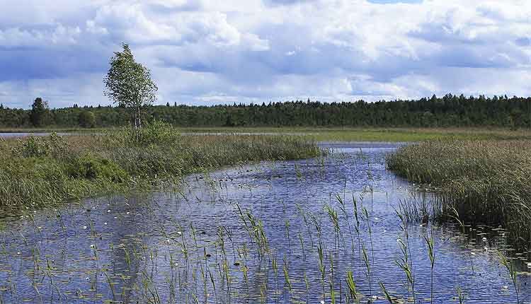
Valgejärve nature trail
Nature trail Valgejärve is located in a recreational area near Keila, not far from Tallinn. The trail introduces visitors to the Valgejärve nature reserve, which is located in the western part of the Nissi parish of Harju County. The beginning and end of the trail is near Lake Järveotsa, and the trail is 6.5 kilometers long.
Description of the Valgejärve hiking trail
The main attractions of the Valgejärve nature trail are the lake and the bog of the same name. There are also places for feeding animals. The ideal time to take the route is mid-summer and early autumn. Snakes live in the bog, so be extremely careful!
The Valgejärve nature trail starts after the car park, and a sign pointing to the forest will guide you there. The path will then pass along ordinary forest paths, in some places of which there are information boards with a detailed description of the local nature. On the approach to the bog, a solid forest path is replaced by a wooden walkway.
There are two places for rest directly on the bog. The first is located at the approach to Valgejärve and consists of two benches, next to which there is a sign with a description of the reservoir and the history of its origin. The second is a little further away and is a wooden hut with a canopy where you can take shelter from the rain.
The wooden walkway has a branch, following which travelers can bypass the lake and enjoy the view from the isthmus that divides the reservoir into two parts. Here, it is worth paying attention to the color of the water: on one side, the lake appears white and transparent, and on the other – red. Blooming water lilies add a special color to the local landscape in the summer.
Photo gallery
Parking
The car park, which has space for ten cars, is located at the beginning of the trail. Here, there is also a picnic area and a dry toilet. Lake Järveotsa is popular among fishermen, and it is possible to cook the fish caught on a campfire on site.
Next to the car park, there is an information board with a map of the route and highlights of the trail. There are four stops along the trail with descriptions of the surrounding area. Part of the route goes along a forest path, while another part is on a wooden boardwalk. There is a wooden hut with benches in the middle of the trail for resting, and a viewing tower in the forest.
Location on the map
Other hiking trails
- If you’re in Tallinn, visit the Õismäe Bog health trail. The Estonian Open Air Museum of Rocca-al-Mare is also nearby.
- One of the most popular hiking spots in Harju County is the Kakerdaja bog trail, where you can take beautiful nature photos.
- In close proximity to Tallinn, there is the Tabasalu Nature Park, where an exploratory trail runs along a high cliff.
